| Table of Contents |
|---|
...
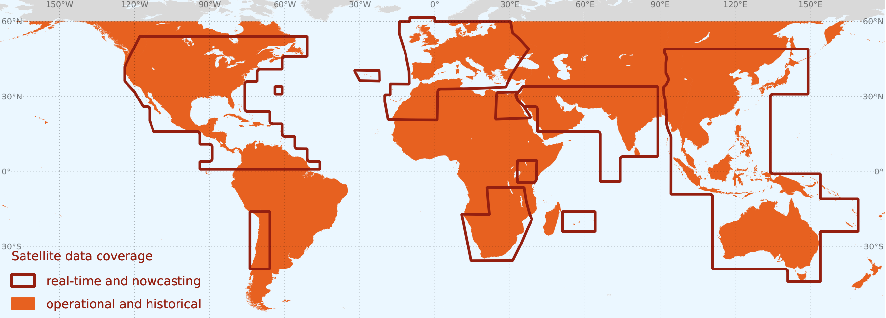
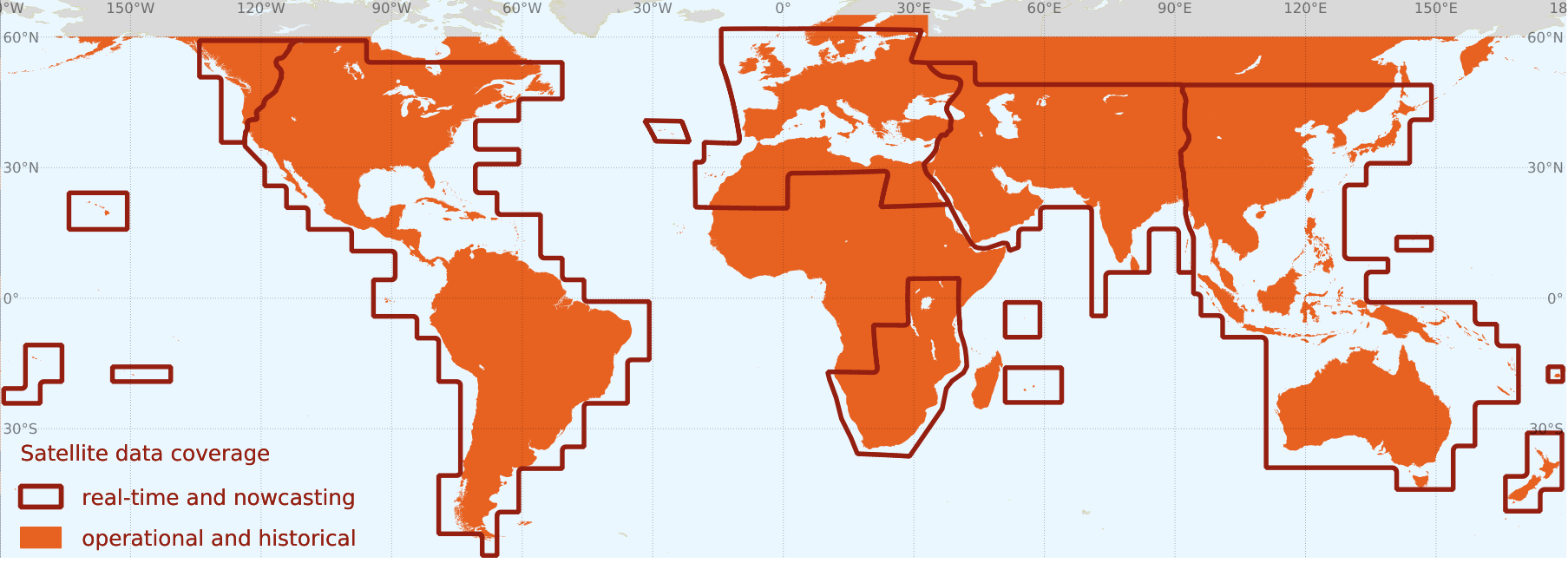
Current spatial coverage of satellite data available through the API.
In the orange regions the satellite data is updated every day (so that DAY-1 is available, see below table for exact timing). Regions outlined by the dark red polygons are updated every 30 minutes (the satellite real-time and the nowcasting data are available up to the current moment plus additional 5 hours ahead). Main data parameters include GHI, DNI, DIF (calculated parameters GTI, PVOUT). | Map of satellite data regions.
|
...
| Note |
|---|
Timestamps used in the XML response comply with the ISO 8601 standard for date and time representation https://en.wikipedia.org/wiki/ISO_8601. Time stamps are also aware of time zone (offset from UTC). Time zone designators are appended after the the time part of timestamp string. If the time is in UTC (https://en.wikipedia.org/wiki/Coordinated_Universal_Time), Z is added directly after the time without a space. Z is the zone designator for the zero UTC offset e.g., 2017-09-22T01:00:00.000Z . If there is an offset from UTC, this is designated by appending +/-HH:MM after the timestamp string, e.g., 2017-09-22T01:00:00.000-05:00 (UTC-5). |
...